Mt Qomolangma (ཇོ་མོ་གླང་མ) (9/25)

"Seeing is believing!" -- this is what I telling people this afternoon. It was truly a unbelievable experience today.
I woke up at 8am in the morning. Looked outside the window, it was raining!!! "Geez, why I had such bad luck", I told myself.
After breakfast (today's breakfast is Changba (糌巴), the 1st changba I ate in this trip), we left Shegar around 9am. At the Lulu Checkpoint, I asked the solider who examined my passport and permit about the likelihood of seeing Mt Qomolangma ("Qomolangma" is the Tibetan name (means "mother goddess of the world") of Mt Everest. It is also the name for the mount used in China . Since here it is Tibet, so I will use the Tibetan name, and forgot about silly nonsense name of "Everest") today. He replied "No way"!!! He also told me that the mount has been covered by clouds and mist for 3 days already. "Today", he said, "we have rain here, so it must be snowing right now in the mountain."
 | The rocks on the hills alongside the highway are very colorful -- brown, red and blue. And the rocks are heavily twisted, a strong evidence that tells why the Himalaya Range has so many top mountains. |
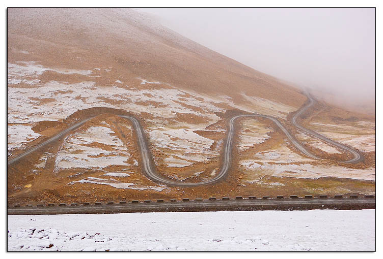 差太远了!) pass. Not surprising, it was snowing here in mountain, even though is far away from the Mt Qomulangma! The road was a series of switchbacks going up the mountains. In the past two days, I found Mr. Danzeng was not a speeding driver, and sometimes I wished he could drive faster (Several days later, I found out the his Land Cruiser is not genuine Toyota 4500, I believed it was a re-make from a Toyota 62. Maybe that explains why it is slow). However, today, under this severe weather condition, he showed off his skill -- passed all other 4x4 we met on the switchbacks! Exciting, but scary.
Finally we reached the Pang-la pass. The altitude reading on my GPS was 5,180m. At Pang-la pass, on a fine day, one supposedly can see four 8000+m mounts of the Himalaya range: Makalu (玛卡鲁峰, 8,463m), Lhotse (洛子峰, 8,516m), Everest (珠峰, 8,848m) and Cho Oyu (卓奥友, 8,201m). However, this beautiful vista was ruined by the snow today. All I could see was a curtain in white!
We continued driving in snow for about two more hours, and arrived at Rongphu (绒布, 5,000m) around noon. I found a room in the guesthouse of Rongphu Monastery. People here don't know how to do math, I guess :P -- 40-yuan/bed for a 3-bed bedroom, but 20-yuan/bed for 4-bed, both rooms a
 re of the same size! I took the 4-bed room, a no brainer.
The restaurant of the guesthouse was packed with travelers from all over the world. They all looked gloomy because of the weather. Of course, how many time one will have an opportunity to come to here visit the tallest mount in the world? And at that moment, it really looked like we all would lose this opportunity today.
Rongphu Monastery is claimed the highest monastery in the world (as least that is what my tour book says), but I doubt that -- at least the Dirapuk Monastery in Mt Kailash tops it, by 5,100m vs 5,020m, based on my GPS's reading.
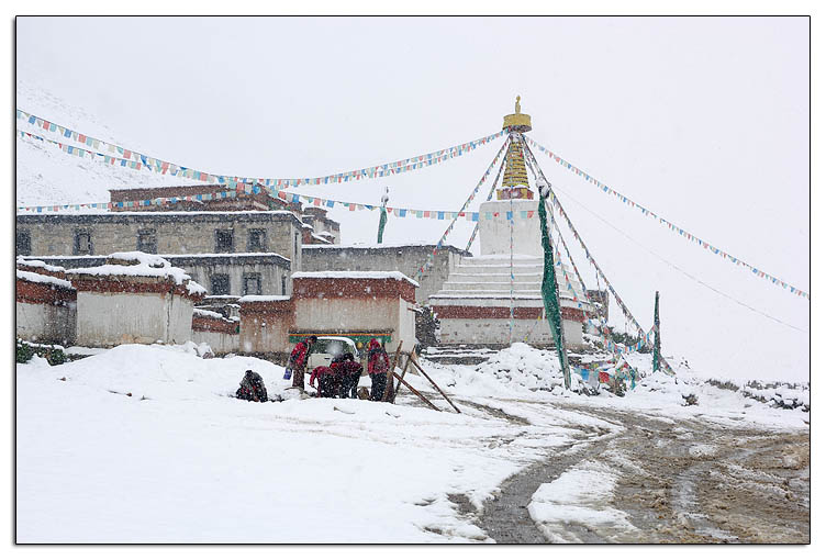 | 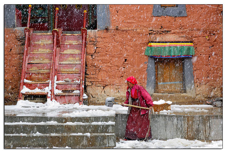 | ||
| Another photo, taken inside the Rongphu Monastery at 2pm. A Tibetan woman was shoveling snow in courtyard. |
 |
| Here is a photo to show how misty it was after the snow stopped. |
I grabbed my camera bags and tripod, went up to the small hill next to the Rongphu monastery. Found a good spot, setup the tripod and the camera, then waited for the miracle to happen. Some locals here said even though the snow stopped, and sun came out, the chance to see Qomulangma is still slim, because the area was still very misty, and windless (w/o wind, no chance to blow away the mist). However, I just did not believe that -- somehow I felt the force was with me, and I would get whatever I hope today!
 | 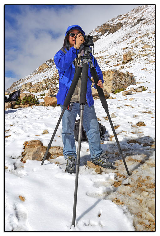 |  |
| Rongphu Monastery. At 5:38pm, Mt. Qomolangma was still hiding behind the mist. But as you can see in the photo, there were more and more blue in the sky, clearly a good sign. | This is me, with the setup of my photo gears. The tripod is a Gitzo 1325, equipped with a Bogen leveling base 3502, and a Markins Ballhead. Hasselblad XPAN is the camera in this photo. | Everyone was waiting for the miracle... |
 |
| We all wanted to save this precious moment forever |
And the miracle did happen! About 5:45, Qomalangma finally took off the mask, showed her beautiful face to us lucky people. We exclaimed our excitement. This is simply unbelievable -- just 4 hours ago it still snowed like hell at here!
The air quality was particularly good after snow. This was the dream moment for any photographers. Click, click, click, kept on going, until the sun was set...
 |  |
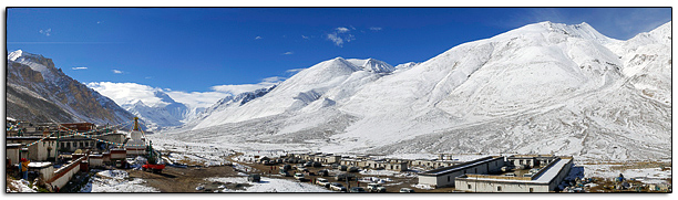
| Rongphu is widely considered the best place to shoot the north face of Mt Qomolangma, because you can use this beautiful chorten as a foreground element. | Sun was starting to set |
 |  |
| Probably it wasn't the right season yet, the sunset was not as spectacular as I hoped for. I did some research after I got home, it looks like colours in May to June are much better. | This was taken after the sun has completely set. The scene was illuminated by twilight in nightfall. |
 |  |
| Compares to its sunset, the sunrise in Mt Qomolangma was even less attractive. Colours were weak (maybe a different season (early spring) will be better), but the real killer is the light -- nothing will look good if it is in shadow! | Mount Qomolangma in morning After taking this photo, we said farewell to the mother goddess, continue to our next destination -- (Old) Tingri. |
To see more photos of Mt Qomolangma, visit the online photo gallery on my website fototi.com (will be launched by the end of November).
Oh, I can't let go an nasty issue, that is the restroom in Rongphu! Man, that was the ugliest, dirtiest and least comfortable toilet I ever seen (actually, days after I found another one that tops it). I don't wanna go into the detail on how the toilet look like, one word, ugly. I just felt amazing why such a beautiful place could have such a unfit thing here. I did not remember I saw such unmatched things in Nepal. Later I met a Tibetan tour guide in the kora road of Mt Kailash. I complained this matter to him, but he laid blame to Chinese government, claiming that the government did not allow locals to do renovation to the guesthouse, in the fear of making local rich. I took that as a grain of salt. I think the real problem is the mindset of the people here.
At last, that was something sad happened on me in here -- I lost my GPS (Garmin Geko 301) that I used on my Nikon D2X to record GPS data into pictures. I don't know where and when I lost it. I found out the GPS was not attached to the camera when I was taking the sunrise pictures in the morning. It is very sad -- now I wouldn't be able to geo-encode my photos when I do the Mt Kailash kora! :(
Next story: Mt Shishapangma
Previous story: Sakya Monastery